


Wildfires are wreaking havoc in Pacific Palisades,Sylmar, and Beyond
Two fast-moving wildfires are wreaking havoc in Southern California, prompting mass evacuations and heightening concerns about the region’s ongoing wildfire threats. The Palisades fire and the Eaton Canyon fire in Altadena have scorched thousands of acres, driven by fierce winds and critically low humidity. Officials warn that the situation is far from under control, with weather conditions expected to worsen.

The Palisades Fire: A Rapidly Escalating Threat
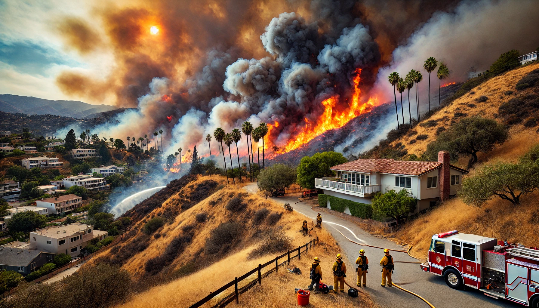
The Palisades fire erupted on Tuesday morning near Piedra Morada Drive, quickly growing to over 2,900 acres by the evening. The Los Angeles Fire Department (LAFD) reported that more than 30,000 residents have been forced to flee their homes as the fire surged through Pacific Palisades, an affluent area known for its iconic boulevards, gated mansions, and landmarks such as the Getty Villa.
Fanned by destructive winds, the fire threatened key locations, including Palisades Charter High School and the historic Reel Inn restaurant in Malibu. The winds’ intensity grounded firefighting aircraft shortly before 8 p.m., complicating efforts to contain the flames. According to Governor Gavin Newsom, the extreme gusts made aerial water and retardant drops ineffective, as they dispersed in the wind before reaching the ground.
“We can’t risk aircraft in these conditions,” Newsom said during his visit to the site. “This is one of the most dangerous wind events we’ve faced in recent memory.”
The National Weather Service has issued a “particularly dangerous situation” warning for extreme fire danger across Los Angeles and eastern Ventura counties, predicting that the ongoing windstorm will be the most destructive since 2011. Winds are expected to peak between 10 p.m. and 5 a.m. on Wednesday, exacerbating the already perilous conditions.
Eaton Canyon Fire: Altadena’s Growing Emergency
While crews battled the Palisades fire, another blaze erupted in the hills above Altadena near Eaton Canyon on Tuesday evening. Dubbed the Eaton Canyon fire, it has scorched more than 400 acres and forced evacuations west of the Eaton Canyon Golf Course. The U.S. Forest Service confirmed that aerial firefighting efforts were also suspended in Altadena due to high winds.
Pasadena Fire Department spokesperson Lisa Derderian expressed concerns about the potential for rapid fire spread, given the fierce winds and dry vegetation. “We’re facing a double-edged sword,” she said. “Strong winds are fueling the fire and grounding aircraft, leaving ground crews to tackle this dangerous situation.”
Historical Perspective: Fires in Pacific Palisades and Altadena
Pacific Palisades has faced similar devastating fires in the past. In 2019, the Palisades fire burned over 40 acres and forced evacuations, though it was contained within days. Altadena, nestled in the foothills of the San Gabriel Mountains, has also experienced wildfires, including the 2020 Bobcat Fire, which scorched over 115,000 acres and caused significant damage.
Climate experts note that the frequency and intensity of such fires have increased in recent years. Daniel Swain, a climate scientist at UCLA, emphasized that climate change is contributing to drier vegetation and prolonged fire seasons. “What we used to call fire season is now a fire year,” Swain said. “These conditions are becoming the new normal.”
Preparing for the Worst: Officials on High Alert
Governor Newsom and local officials have pre-positioned resources in high-risk areas to address potential new ignitions. “We are anticipating additional fires,” Newsom warned, urging residents to remain vigilant.
Emergency shelters have been set up in nearby areas to accommodate evacuees. Residents can check real-time updates on evacuation zones via tools like the Los Angeles County Fire Department’s interactive fire map and Cal Fire resources.
Evacuation Orders and Safety Tips
As the fires continue to rage, officials have issued mandatory evacuation orders for parts of Pacific Palisades and Altadena. Residents in affected areas are urged to:
- Pack essential belongings, including important documents, medications, and emergency kits.
- Follow official evacuation routes and avoid closed roads.
- Stay informed through local news outlets like KTLA, Cal Fire, and the Los Angeles Times.
Long-Term Implications
The ongoing fires highlight the need for long-term solutions to address wildfire risks in Southern California. Experts point to vegetation management, stricter building codes in fire-prone areas, and investments in firefighting technology as critical steps to mitigate future disasters.
Meanwhile, the immediate focus remains on containment. With winds showing no signs of relenting and humidity levels plummeting, firefighters face an uphill battle to protect lives and property.
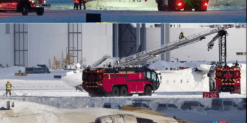
Sylmar Fire: A New Blaze in the North
After 10:30 p.m. on Tuesday, officials issued mandatory evacuation orders for the Sylmar Fire, also referred to as the Hurst Fire. Initially estimated at 100 acres, the fire rapidly grew to 600 acres by midnight. The flames first broke out north of the 210 Freeway, near the 5 / 14 split, prompting the Los Angeles Fire Department to order evacuations in the following areas:
Mandatory evacuation for North of 210 Freeway from Roxford to the Interstate 5 / 14 Freeway split
Evacuation Warning (in yellow on map): 5 Freeway to Woodley/Balboa to Lahey Street to Zelzah Ave
Stay Updated
For the latest information on the Palisades fire, the Eaton Canyon fire, and other Los Angeles fires, visit official resources like Cal Fire and the Los Angeles Fire Department’s website. Residents can also track evacuation zones and fire progression through platforms like the California Wildfire Map and local news outlets.
Southern California’s wildfire crisis serves as a stark reminder of the challenges posed by climate change and urban development in fire-prone areas. As communities rally to support those affected, the hope remains that lessons learned from these disasters will lead to better preparedness and resilience in the future.


